
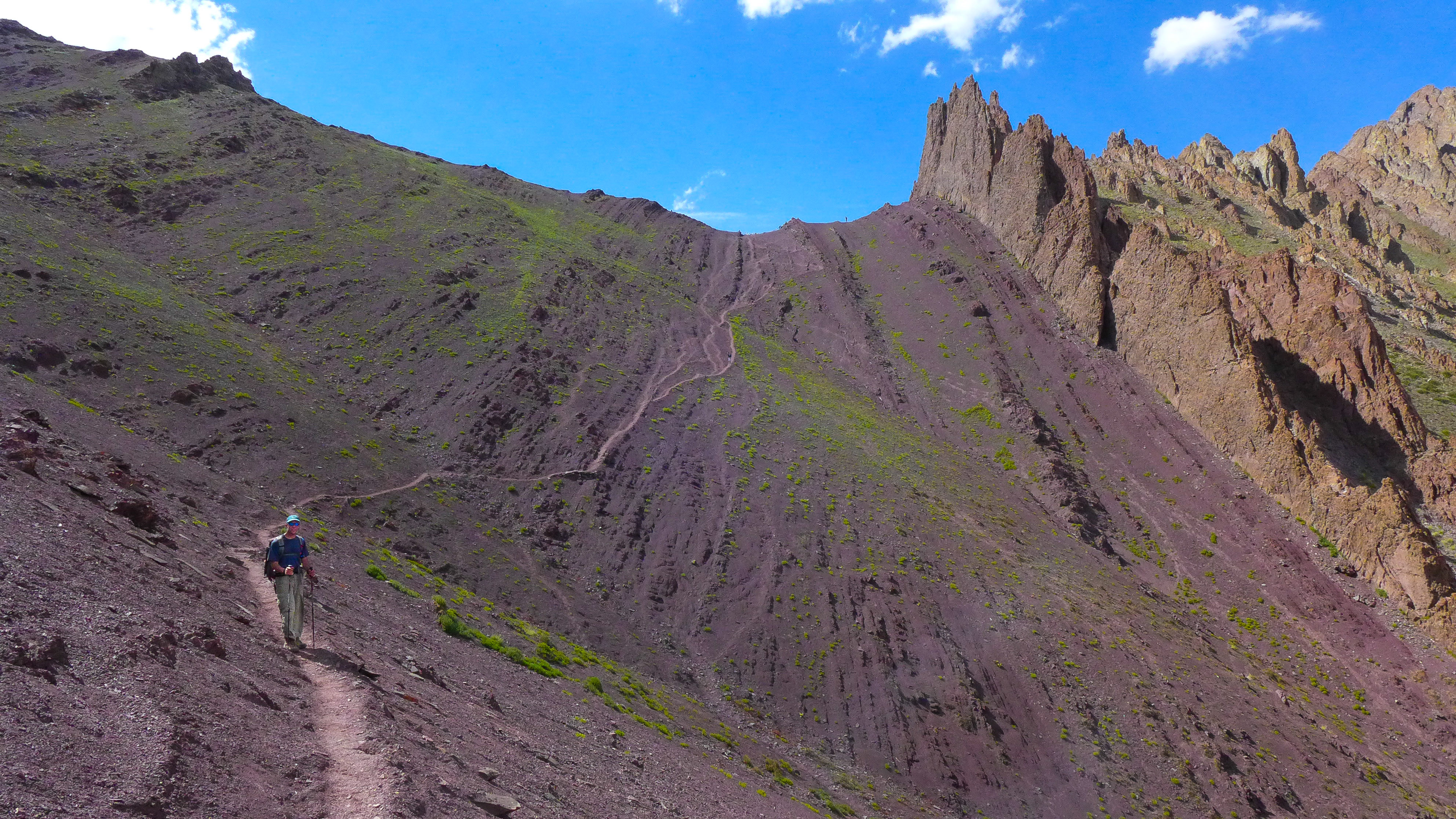
“There’s another pass?,” we asked incredulously, as we stood at the top of Stok La (4860 meters/15,940 feet) and stared at the sheer, vermilion-colored wall of rock still ahead of us. Our hearts sank as our gaze followed the narrow footpath climbing vertically at a nerve-wracking angle to the saddle-shaped pass ahead. “You’re kidding, right?”
Normally, we are not so unenthused when we hike, but, at that particular moment, we couldn’t help it. This happened to be the third pass over 4500 meters (14,764 feet) that day, and our trekking guide, Angchuk, had only told us about the first two of them when we discussed what to expect on the trail that day over breakfast. If this was Angchuk’s idea of a joke, we weren’t laughing.
We’ve found that so much of hiking involves overcoming mental challenges, and knowing what lies ahead can be a huge help. We had been so excited to reach the top of Stok La and celebrate the end of the hard uphills for the day—it was going to take some time to mentally prepare for the unexpected pass on the horizon.
Of course, there was no other choice but to press on, yet we knew this last stretch of trail would be the most difficult. Typically we have found that mountain passes appear easier the closer you get to them. What looks dreadful from a distance becomes surprisingly achievable up close. But after ten days on the trail in Ladakh, we had learned that the opposite was often true here, making our present circumstance all the more undesirable. Getting over this last pass was going to take a Herculean effort.
Indeed, it takes determination just to get to Ladakh and even more persistence to trek in this isolated and arid landscape in the far northern reaches of India. But the rewards are sublime. Ladakh has an enchanting and timeless appeal that grows with every hard-earned step.
On our traverse along the Stok mountain range, we observed an ancient culture still engaged in the age-old practices of mountain life. We hiked beneath snowy peaks looming high above vast mountain meadows where shepherds tended their flocks of grazing sheep. We conquered lofty passes adorned with white-washed Buddhist chortas, colorful prayer flags and reverent mani walls. We enjoyed humbling panoramic views of the Himalayas all to ourselves. Add to that the allure of a 6153 meter (20,187 feet) peak that requires no technical climbing skills to summit, and it’s easy to understand why trekking in Ladakh feels like reaching a hiker’s nirvana.


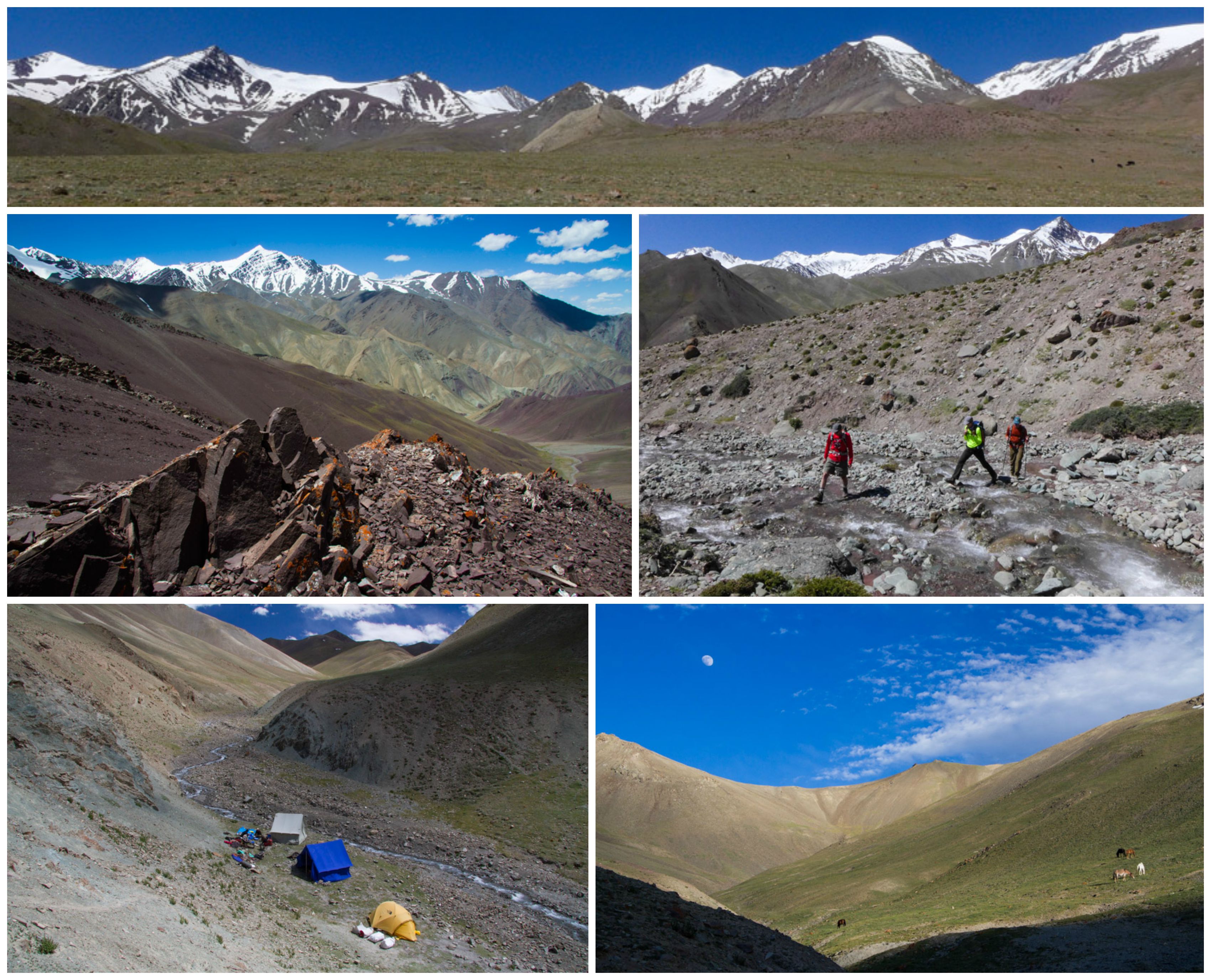
For 12 days we journeyed through this intriguing high-altitude world on the fringes of Tibet, on a traverse along the east side of the Stok mountain range with a Ladakhi guide, a Nepalese cook, a super-hip horseman and two friends from Colorado to help share the experience. Here are some of the highlights from the trail of an unforgettable trek on “the roof of the world.” We hope you enjoy. Namaste!
Day 1: Martselang to Shang Sundu
We started our traverse of the Stok mountain range in the early afternoon at a small Buddhist temple, where we each walked around the prayer wheel to foster good karma on the trail. For the next few hours, we walked along a fairly level road which followed a picturesque river before arriving at our camp for the evening. The colorful mountain backdrop was stunning and whet our appetite for the amazing landscapes we would see on the days to come.


Day 2: Shang Sundu to Shang Phu
We set off today under bright blue skies dotted with fluffy white clouds, near perfect conditions that would become the standard for the rest of our trek in Ladakh. Our hike out of camp began with stunning views of arid, sparsely vegetated mountains and snowy peaks. We ascended the valley and boulder-hopped across several streams before the trail started to really climb. Several hours of huffing and puffing later, we finally crossed Gyuncho La, our first pass, at 4700 meters (15,500 feet) before dropping down to camp at 4365 meters (14,320 feet). We were relieved to catch sight of our tents and rest our weary bones after our first full day on the trail.


Day 3: Shang Phu to Zurley
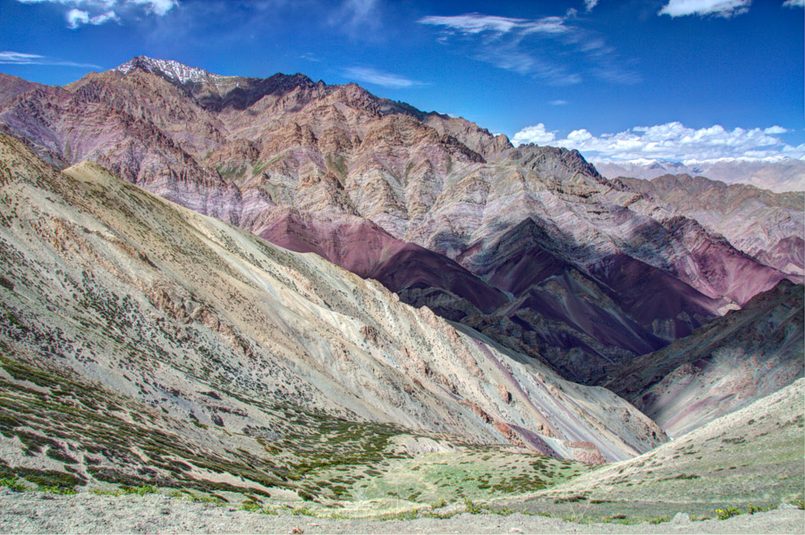
A gentle 600 meter ascent led us through purple vermilion and verdant green hills up to Shang La pass at 4940 meters (16,210 feet). Along the way we encountered a herd of dzo quietly grazing in a meadow. These gentle-looking creatures are a crossbreed of yak and cow unique to this part of the world. From the top of the pass, we enjoyed the impressive views in all directions before beginning a gradual 500 meter descent down to camp through a beautiful valley still covered in snow. Arriving in camp on the earlier side, we took advantage of the time for some well-deserved relaxation.


Day 4: Zurley to Gyang Puche
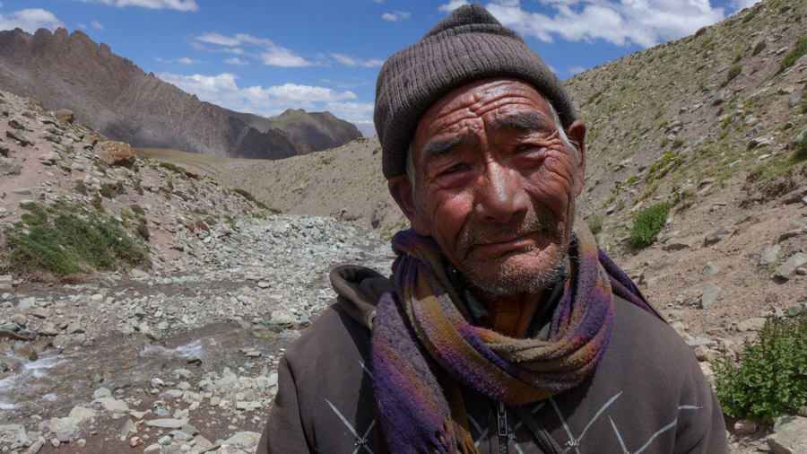
We had a 5-hour leisurely hike up to today’s pass. When we finally reached the top, it felt like we had turned the corner from one picturesque valley into the next with views toward Matho village and the snow-sprinkled Ladakh Range now on the horizon. We crossed two rivers and were photographing a picturesque waterfall when we met a friendly local returning to his village for the evening who was kind enough to pose for our cameras. Back on the trail, we passed two small shepherd encampments on our way to camp, which had been set up in a meadow with awesome views of Matho Kangri, an impressive peak at 5900 meters (19,356 feet).


Day 5: Day Hike to Matho Glacier
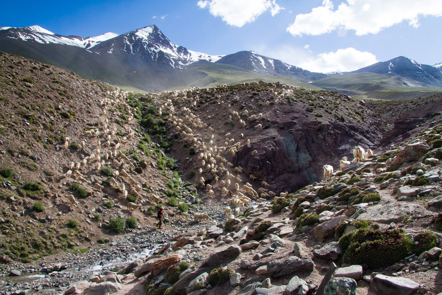
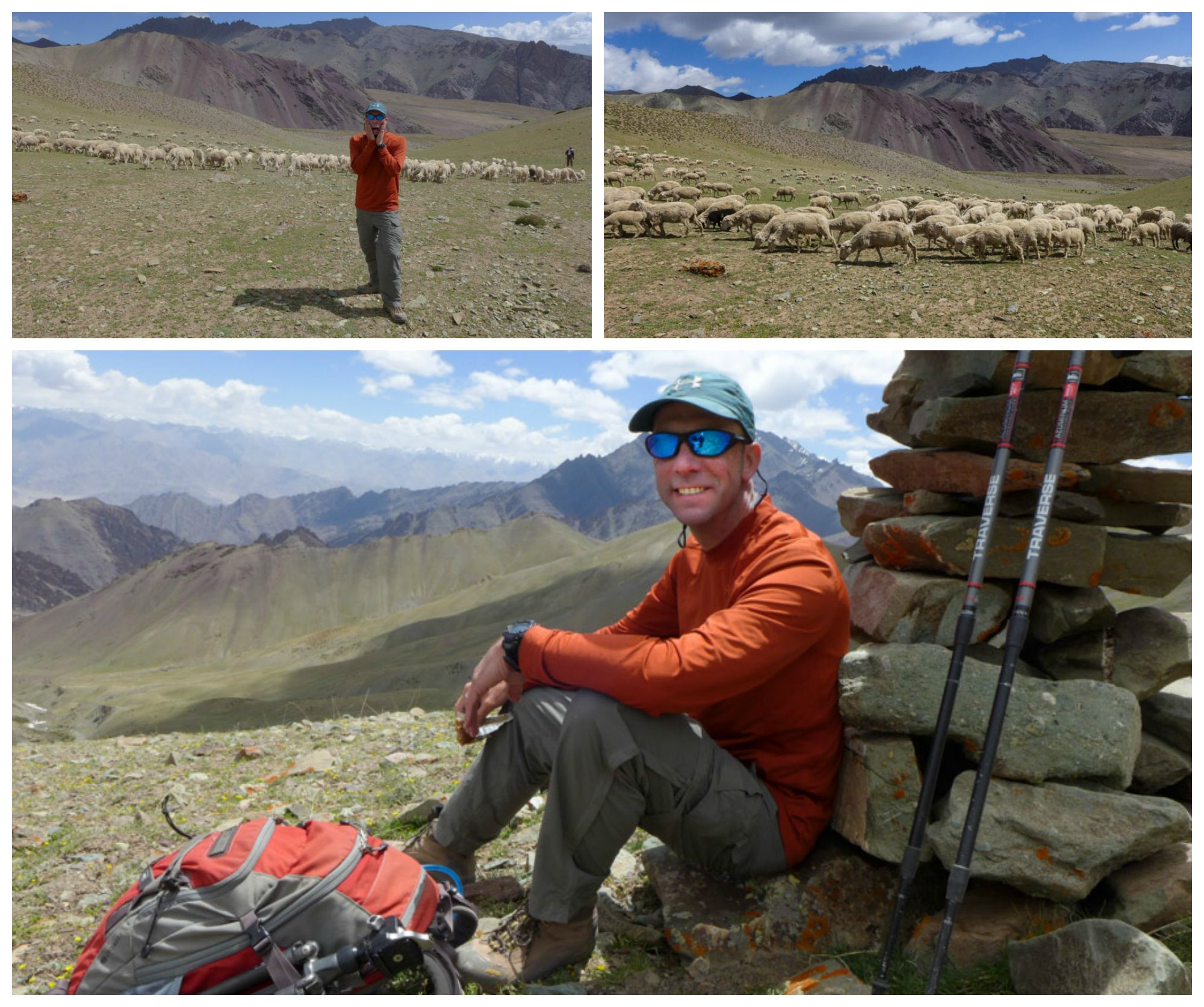
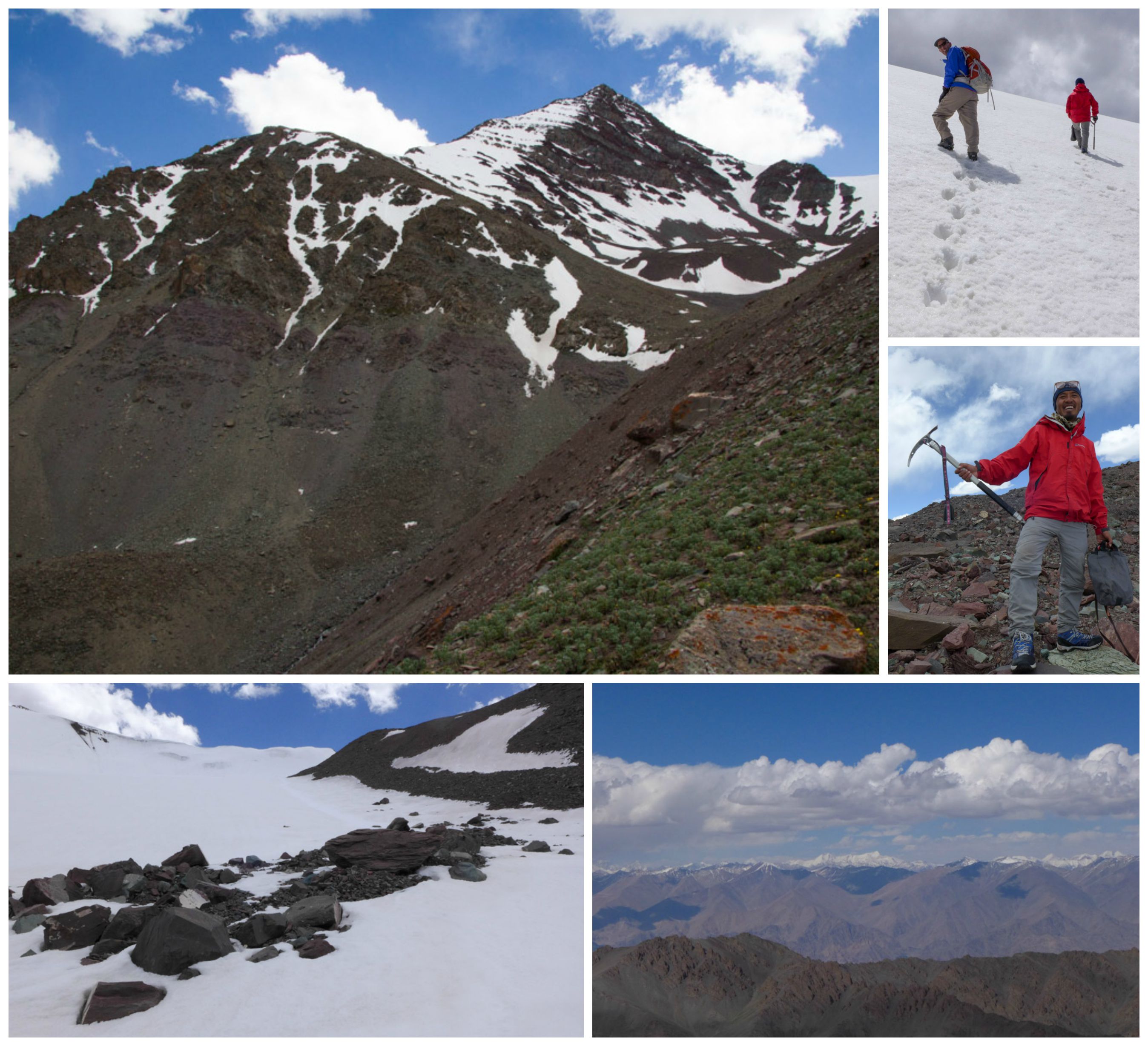
It was a beautiful morning as we set off on an ambitious day trip requiring a 1000-meter ascent up an expansive meadow toward snowy Matho Kangri. Once there, we hoped to practice using crampons in preparation for a summit of Stok Kangri. Still struggling to acclimatize to the high elevations of Ladakh, we were humbled when we were easily overtaken by a huge herd of grazing sheep.
After stopping for lunch in a boulder and scree field just below the glacier, Matt, Rob and Amy donned crampons to traverse a snowfield and ascend to a higher ridge. Continuing a few hundred meters farther, they reached a vantage point where they took in the impressive views beyond the Ladakh range to the Great Himalayan Range, where the road to Kardung La (the highest pass in the world), the mighty Indus River Valley and the distant peak of K2 were all on display! On the way back to camp, we saw the sheep crossing the river, a scene reminiscent of the wildebeest migration in the Serengeti.
Day 6: Gyang Poche to Labar River Camp
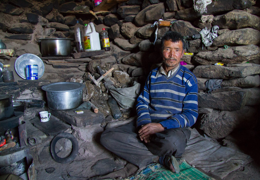
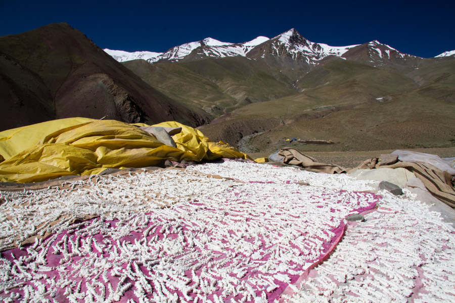
For breakfast this morning, we were treated to delicious fresh cheese and yogurt made by the shepherds living in the camp adjacent to ours. We asked Angchuk if it would be possible to pay a visit to the camp before hitting the trail, and much to our delight, the three shepherds living in the summer camp were willing to give us a tour. Their living quarters were tiny stone hovels, and it was fascinating to see how they managed to dwell in these rustic conditions for months on end. They allowed us to visit their sleeping quarters/kitchen and showed us how they boil the sheep’s milk into yogurt for making cheese and lassis. Before our departure, they insisted we taste a few pieces of churpe, slightly sour, dried cheese that Ladakhi shepherds like to snack on while pasturing their sheep. Our hosts told us it would give us good energy on the trail, so we happily accepted a handful of the tasty treats for the road.


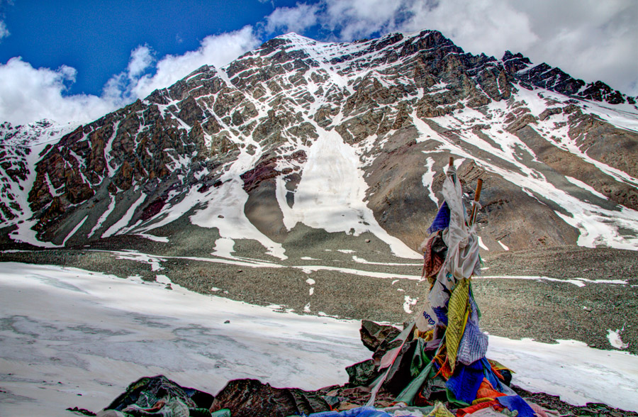
After bidding our new friends farewell, we set off on the hike up and over Matho La (4930 meters/16,174 feet). The views of the Matho Kangri range all covered in snow were superb, and, when we finally reached the top of the pass, we were greeted by a welcoming party of a few grazing dzo. From there, it was a short and steep stroll down into the next valley to a riverside camp off the beaten path where we treated ourselves to an ever-so-brief dip of the feet in the icy-cold Labar River.
Day 7: Labar River Camp to Stok Kangri Base Camp (Yarlas)
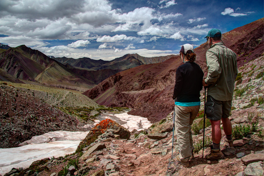
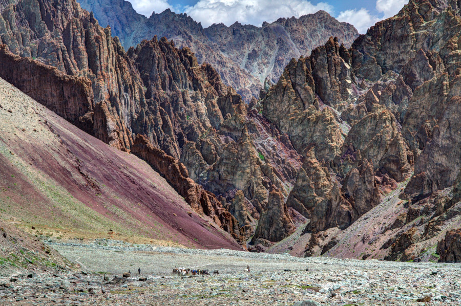
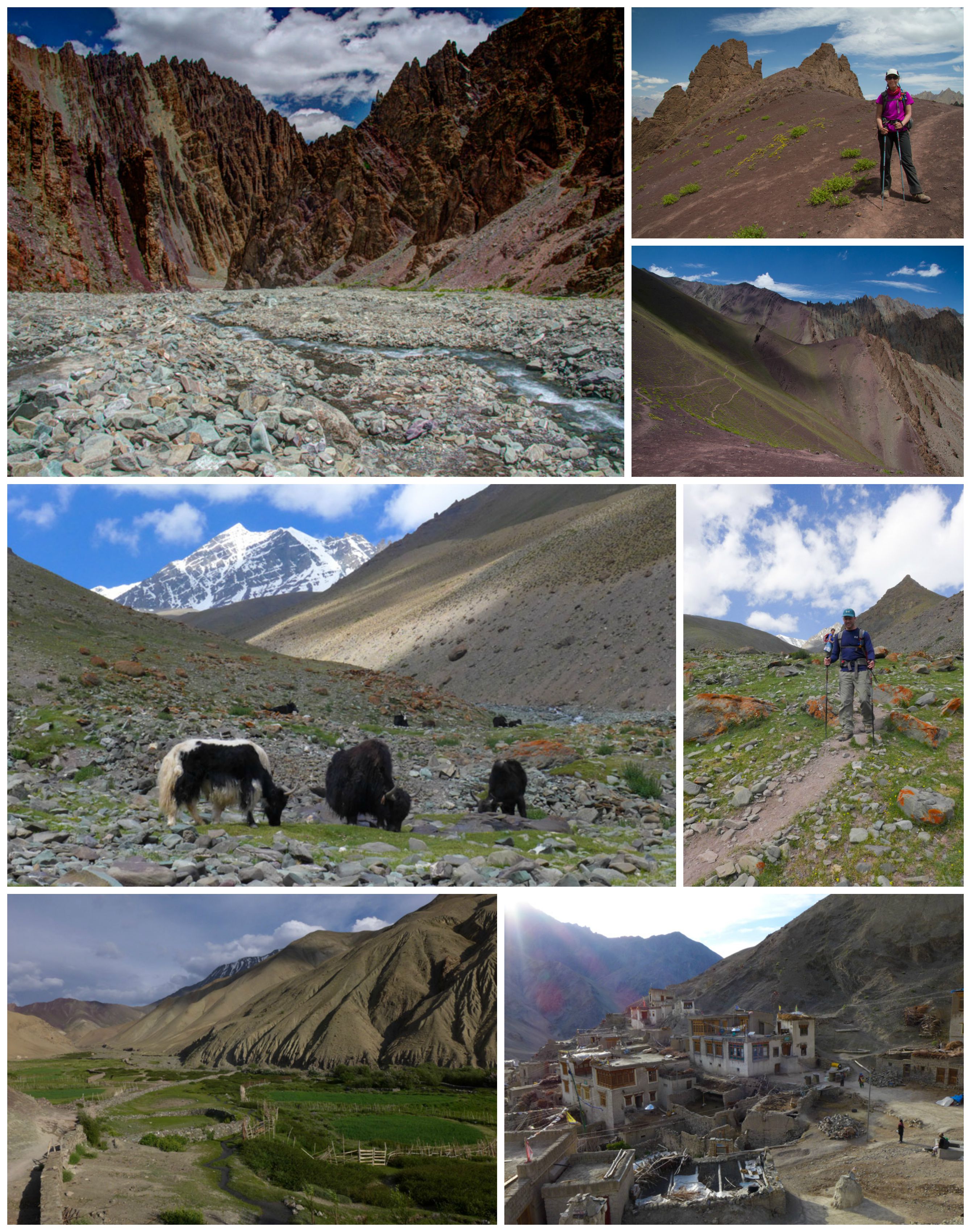
Today provided some of the most beautiful scenery we encountered in Ladakh. The day started with a memorable 3-hour stroll that took us along a level, but slightly precipitous, narrow path high above the river with amazing views of a Dali-esque pink and beige-striped valley. From there, the trail turned towards Stok Kangri, and we gradually made our way up an idyllic, verdant valley where we passed flowers, birds, marmots and gurgling streams on our way to base camp at 4980 meters (16,338 feet).
Base camp is attractively set in a glacial bowl with a stream running alongside that turns reddish with meltwater during the heat of the day. There were approximately 30 tents set up alongside us in the base camp for the various groups attempting to summit, which was surprising considering we had only seen a handful of hikers up until this point. We were also amazed to find a volleyball court (at this altitude?!) and a yurt cafe where hikers could rent climbing equipment and get basic food and beverages (including beer). We took a late afternoon hike up the steep hill beyond camp that starts the climb to Stok Kangri to get a commanding view of the region. Beautiful!


Day 8: Day Hike to Stok Kangri Glacier
Today was billed as a rest day, but we used it as an opportunity to get a sneak peek of what we would encounter on the trail to Stok Kangri. We ventured beyond the steep hill and followed the trail across several snow fields on the way to the Siachen Glacier where crampons would likely be needed for the ascent of Stok Kangri. It would have been fun to walk on the glacier, but we arrived around lunchtime, and the snow/ice was already too soft to cross safely. We took an alternate route back to camp and saw some of the curious flora that manages to grow in this extremely harsh environment. We spent the rest of the afternoon relaxing in camp in preparation for the 12:30 am ascent of the summit.


Day 9: Stok Kangri Ascent
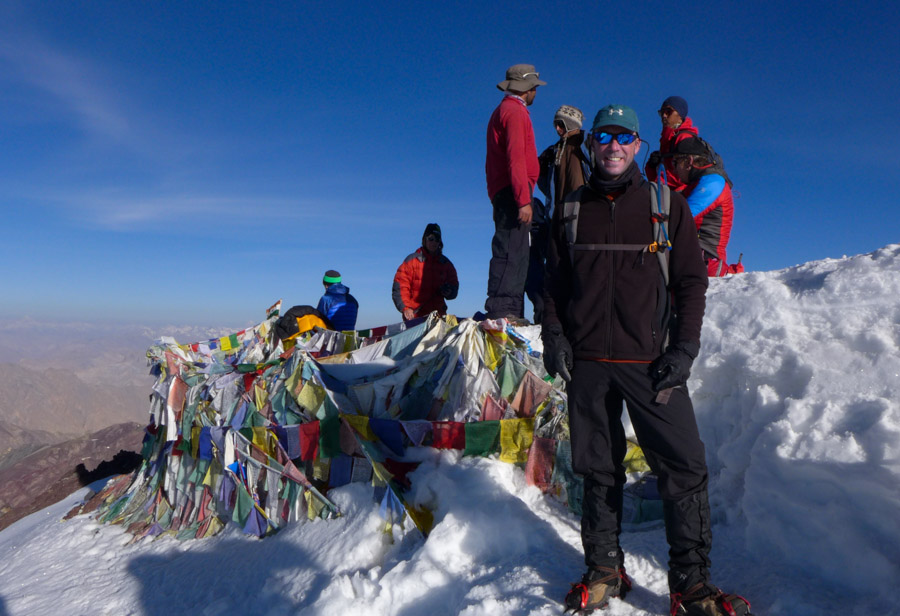
Matt’s Day: After struggling to wake up Angchuk (twice!), we departed at 12:55 am with Rob and Amy following half an hour later. We met up at the base of the glacier and began trekking as a 5-some, with local guide Stanzin who had only summited 4-5 times previously. With a full moon to light the way, comfortable temperatures and virtually no wind, we were all thankful for the nearly ideal summit conditions. We crossed the glacier field on a diagonal, leaping one small glacial river in the middle, before beginning the long, arduous ascent on icy snow to the top. We found the footing fairly secure and avoided wearing crampons for the ascent. We proceeded at a steady pace, resting briefly as needed up to the first ridge at 5800 meters, which we reached just in time to catch the glorious sight of the moonset and sunrise simultaneously! The last 300 meters up to the summit followed a narrow, rocky ridge line covered partly by snow.
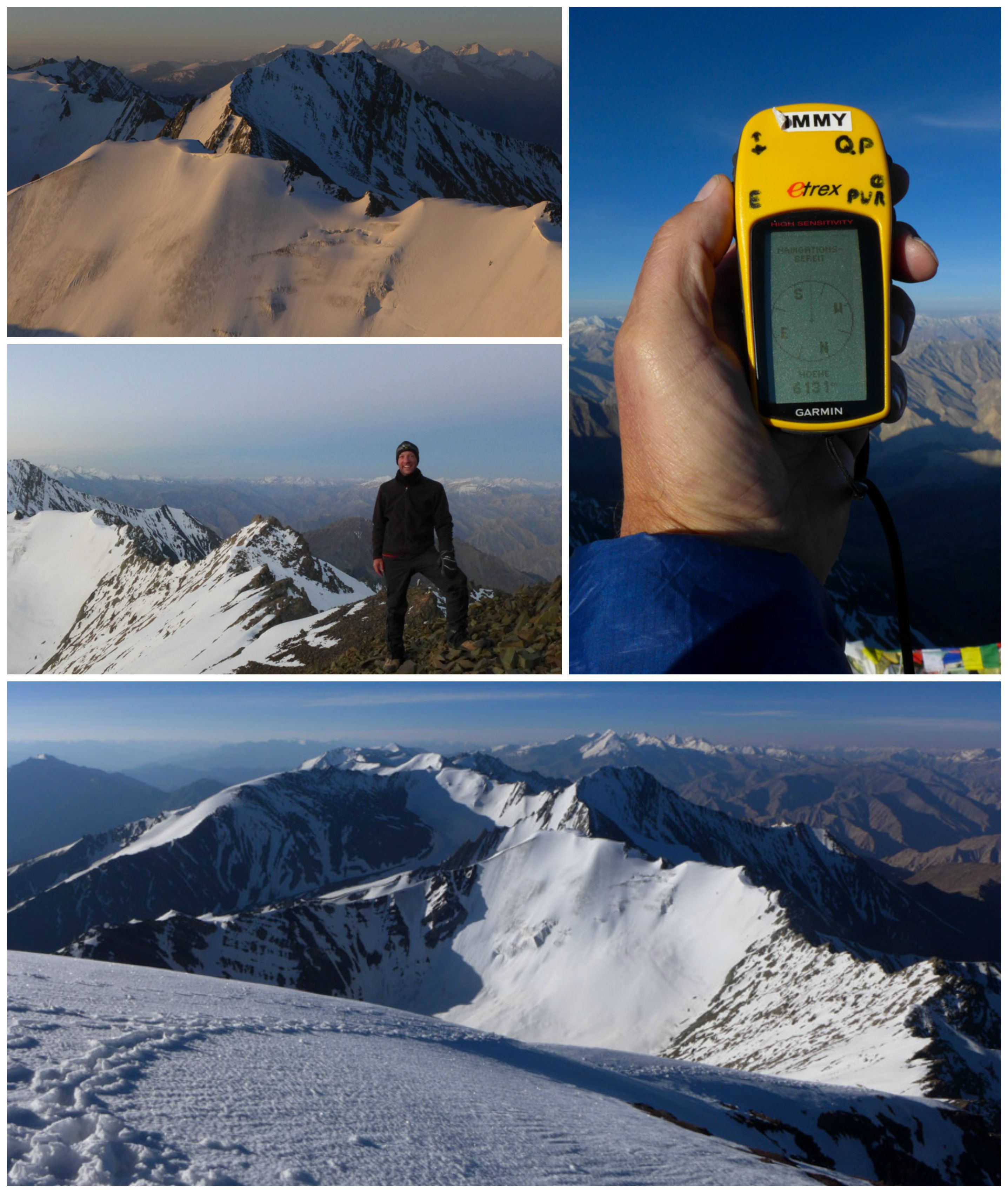
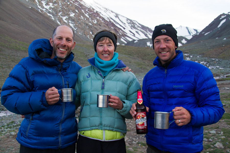
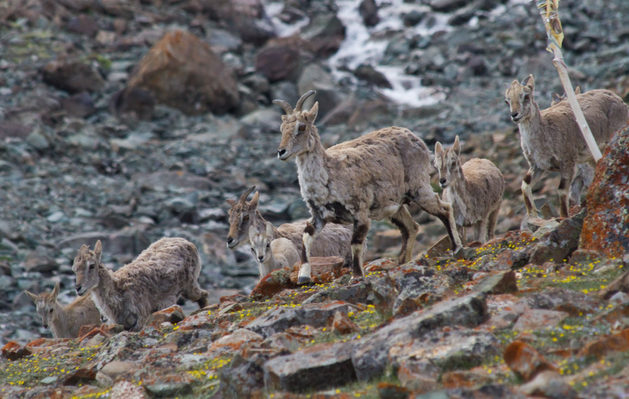
We arrived on the summit by 6 am and spent the next 45 minutes enjoying the incredible 360-degree views of the 6153 meter (20,187 foot) summit and surrounding mountain ranges. As the sun rose higher, the snow quickly turned mushy, so we strapped on the crampons for the steep and slippery descent. When we reached the glacier field, the melting meant that we now had to cross not one, but three glacial run-off streams. We made it back to base camp by 10 am for a grand total of 9 hours of hiking start to finish. We were super lucky to time our arrival back to camp just as a large herd of blue sheep was crossing the river behind camp! Much-needed naps (and beer) were enjoyed by all this afternoon.
Alison’s Day: I made the difficult decision not to summit Stok Kangri for several reasons, including:
- Lack of experience of our guides
- Lack of knowledgeable, first-hand information about the terrain encountered on the trail
- No personal experience using crampons and ropes ever before (and not wanting to learn at 20,000+ feet!)
- Fear of slowing our group down too much
I know this was the right choice for me, but I was still quite sad when Matt set off in the dark of night, knowing that this would be an awesome hiking experience that we wouldn’t be sharing. I spent my morning in camp, photographing the birds and marmots that make their homes in the nearby meadow. I decided to hike up the steep hill above camp to greet the group on their way back from summiting. Just as I hit the trail, I noticed a herd of blue sheep wandering into camp. I raced back to the tent to grab my long lens and spent the next few hours photographing the sheep as they moved through our camp. Later, I was relieved when Matt, Rob and Amy finally returned to camp safe and sound, and I enjoyed hearing about their summit experience.


Day 10: Base Camp to Rumbak Village
Today was our longest trekking day yet, but the superior, ever-changing views on display from start to finish helped keep our minds off the grueling trail ahead. We began the day by descending the long valley below base camp that we had ventured up three days prior. After passing a small, tented camp, we followed the broad, rock-strewn valley toward Stok Village before turning to our left and ascending three successively higher passes at 4580, 4750 and 4900 meters (Stok La). The final descent from Stok La was a steep 900 meter drop into the increasingly arid Rumbak Valley. As the sun sunk low and our shadows grew long, we limped our way into quaint Rumbak Village, home to nine families and their cattle and horses. Our camp was pleasantly located on the outskirts of the village, but we noticed lots of homestay opportunities in town. On another trip, it would be cool to experience a little bit of Ladakhi culture by staying with one of the families here. For now we were grateful to put down the poles and rest our weary bones.
Day 11: Day Hike to Ganda La Pass
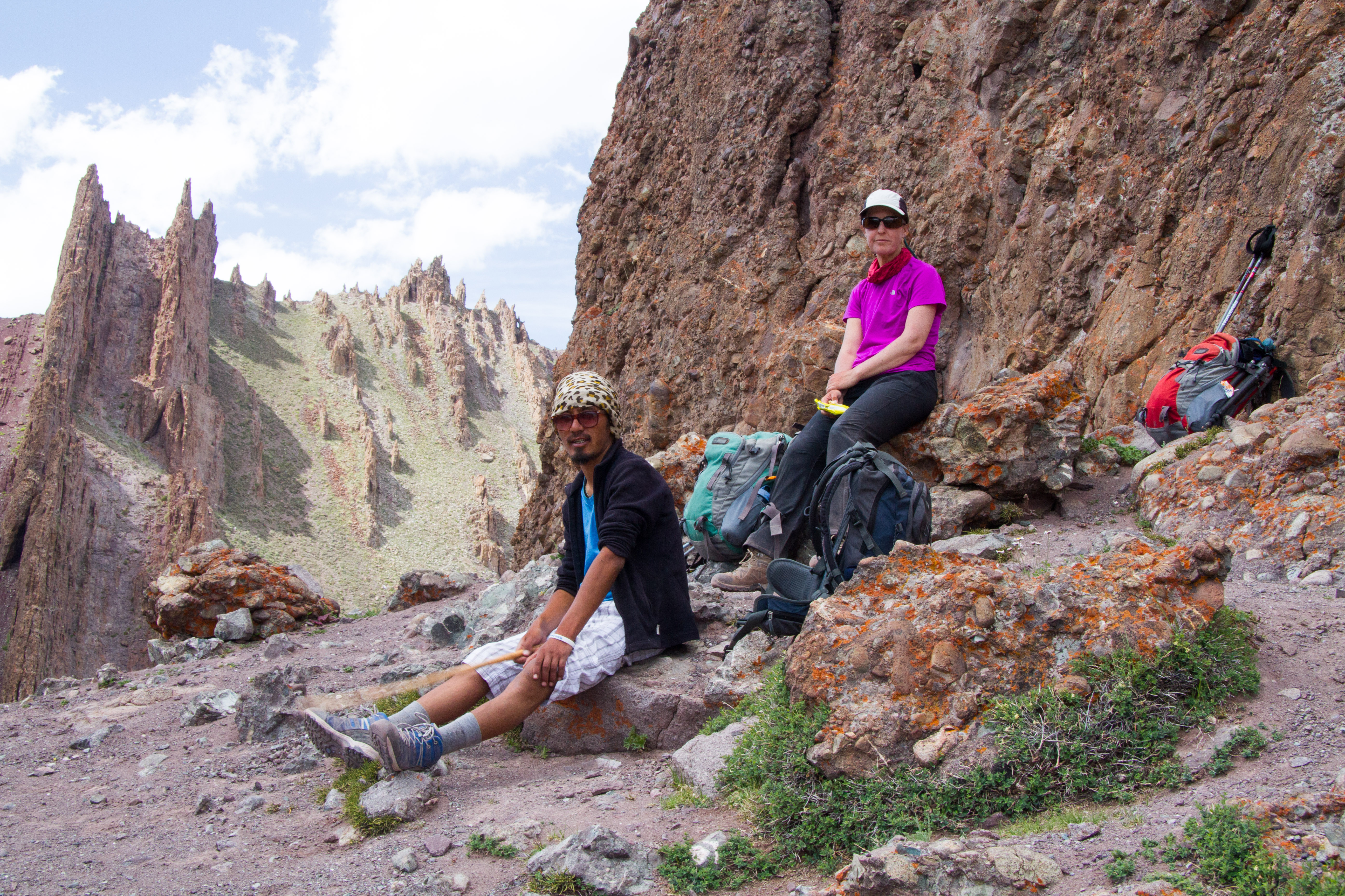
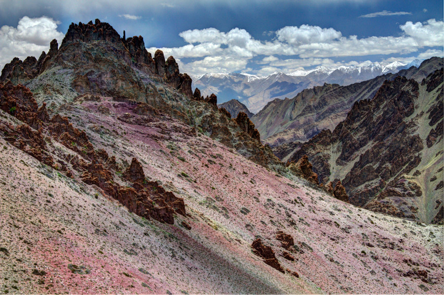
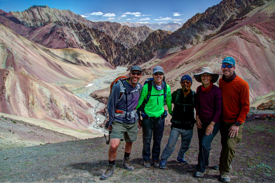
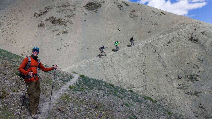
The last great challenge of our Stok Range traverse took us on a day trip outside of Rumbak Village to Ganda La Pass. We set off around the corner from Rumbak and headed down to a broad rocky river bed where we crossed several small streams and zigzagged our way across the valley. We made a gentle ascent along the valley until the trail split to our right. From there, we hiked past striking green and maroon colored rock formations and eventually through the one-house hamlet of Yungtse. Farther on, we enjoyed a rest at a parachute tea house (run by our horseman’s son) before slogging our way up to Ganda La at 4960 meters (16,270 feet).


On the return trip to camp, we ran smack dab into Marmot Mania! We were able to edge very close to some marmot holes where two groups of baby marmots tentatively poked their heads out and then bravely inched forward. We easily spent over an hour watching them play with each other or try to cling to the edge of the slope while napping in the sun. Shortly after that, we stumbled across two adult marmots up on their haunches and boxing in what appeared to be a choreographed ritual. We never figured out what the big fight was about, but it was highly amusing!


Day 12: Rumbak Village to Zinchang

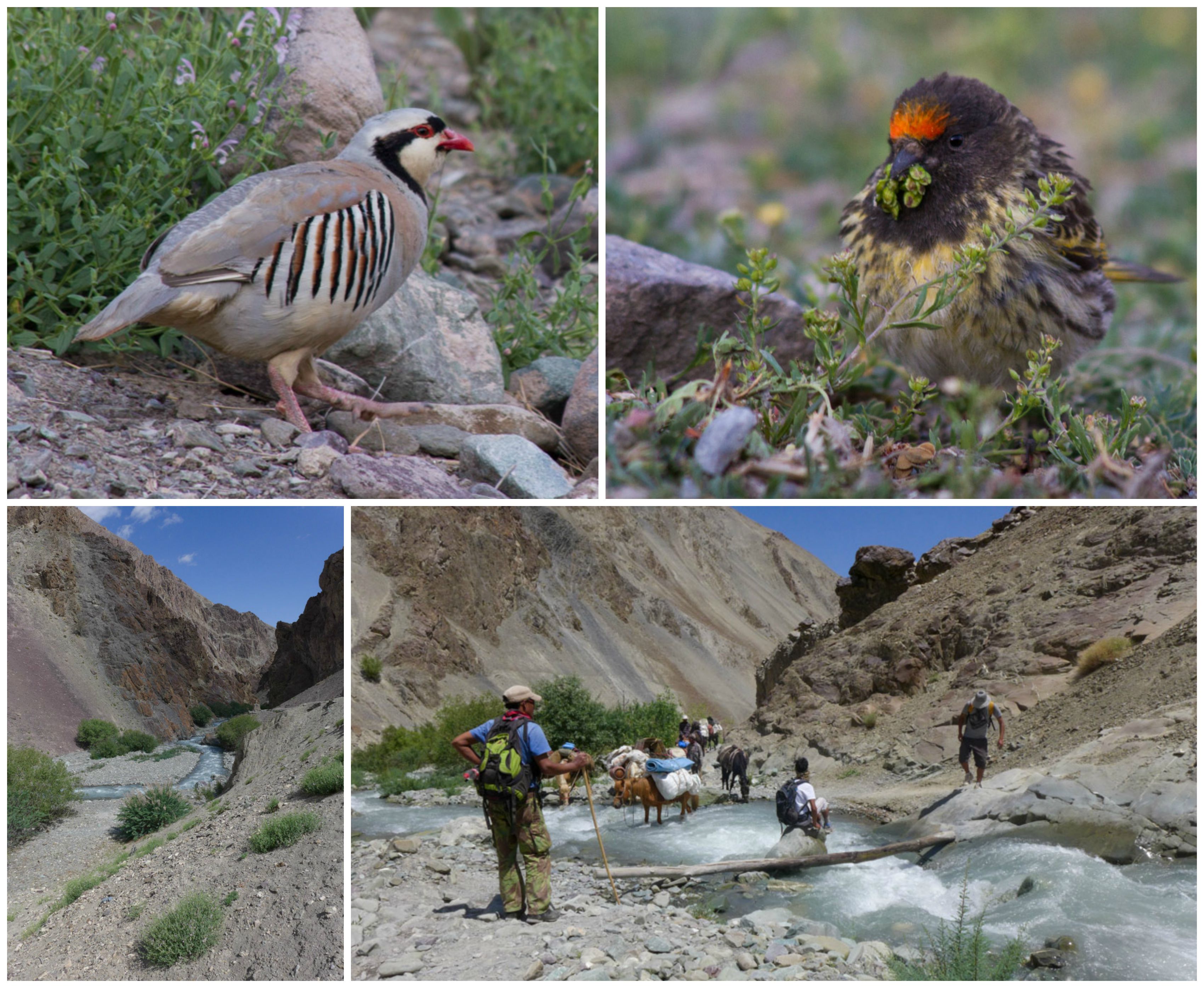
With only a short distance to go today, we lingered in camp this morning and admired the birds who ventured near our tents, including the striking Tibetan snowcock and a fire-fronted serin gathering its breakfast. It was a short 2-hour stroll down the increasingly narrow river canyon to the end of our trek. Along the way, we passed hordes of first-day trekkers (along with their crews and donkeys) beginning the Markha Valley trek on a scorching hot day. Many had looks of exhaustion and exasperation, and we imagined most were probably wondering what they had gotten themselves into. Seeing this, we were all extremely grateful to have altered our route, allowing us the opportunity to trek in cooler climes and on far less crowded trails on the east side of the Stok Range. We crossed the rushing Rumbak River several times before hitting the official entrance to the park and the road out to Zingchan where we arranged for a car to drive us back to Leh.
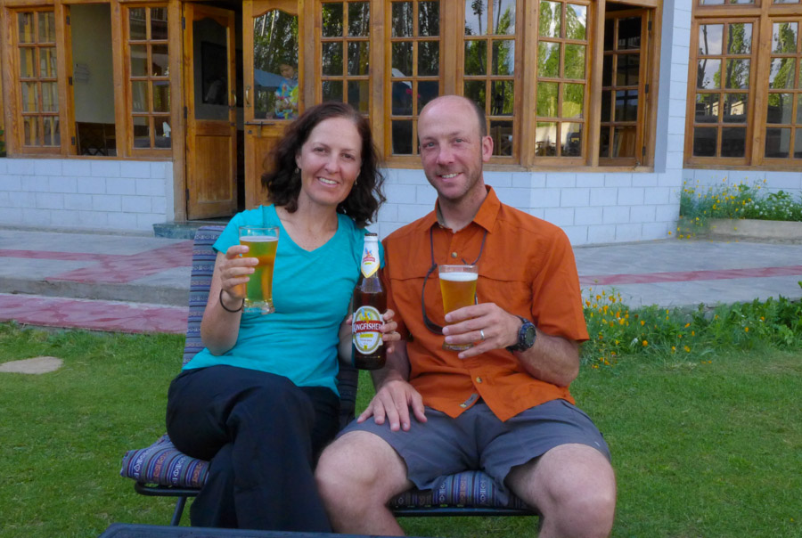
We were definitely happy to be back in civilization after a successful trek and ready to enjoy a well-deserved shower, a cold Kingfisher and a soft bed. Cheers to a spectacular time in Ladakh!


Wonderful Post.
Thanks so much. Ladakh is a wonderful place!
Wow what an experience. I can only imagine the disappointment of having to do another pass to finish off the day. So many steps and altitude changes – you must have felt like you were living in another world. So did you stay on good terms with your friends? Experiences like that can make it go either way.
Not surprisingly, I loved Marmot Mania. What a hoot that would have been to see.
Rob and Amy made terrific trekking partners. The only problem was that they are from Colorado and do 14ers for lunch–they ran circles around us! Stay tuned for our next post, Lyle. It’s all about the marmots, and we did our best to channel our inner-Lyle when we wrote it!
You guys/gals rock!! Awesome pictures & writing. Love to trek there. Thanks for sharing this.
Thanks, David. An avid mountaineer like you would love this area of the world.
I love these posts. You have such an excellent variety of photos, with landscapes, people and wildlife. It feels like we are on the journey with you, minus the cold, pain and awe, of course. I can only imagine how unbelievable those vistas must be. Thanks for sharing!
Thanks, Jeff. Sometimes living vicariously can be the best way to go, especially on those freezing nights in the tent, sleeping at 16,000+ feet! You can give it a try when you are in Mexico this winter. You wouldn’t necessarily think it, but there are some really high mountains there!
How cold did it get at night in India?
I was surprised by some of the mountains in Mexico. You can hike at 10,000 feet one day and be on a beach the next.
It was definitely cold at night, but I am not sure of the exact temp. My guess would be around 35-40 degrees or so overnight. It felt a LOT colder in Peru this past summer – not sure why. I know how much you love hiking from your time in Indonesia, so I expect you to give some of those really high, challenging mountains a try!
So this is where you are all the time instead of taking care of your dear old Dad.
You wouldn’t want it any other way, right?
Now I know why I crawled into the tent and slept away after our 9+ mile hike in OR, and you were ready for much more! Fantastic scenery, but I am amazed at the stamina of all. Another question: How many pix did you have to take of the 2 of you jumping before you got both of you well off the ground?
By this time, you are well aware of my jumping prowess – it probably only took 15-20 tries. 🙂
G R E A T post and wonderful photos !!!
Thank you. We are happy to hear you enjoyed it!
Utterly stunning!!! Clear, crisp, colorful and rugged. Thanks for the report!
Your words describe the landscape of Ladakh perfectly. Thank you for reading!
Wonderful. Beautiful photos. I know what a challenge it is to take photos while trekking.
Thank you. Taking photos can be a challenge, especially at this altitude, but we often find it’s just the motivation we need to keep going!
Amazing Ladakhoscope.Looking forward to more.
Love your term “Ladakhoscope.” We might have to apply that to some future destinations. Thanks for reading!
Thank you.Getting” Leh”ed has been one of the most wonderful experiences in my life.Want to go there again before it becomes a regular tourist destination.
Your trips and treks are beyond inspiring! Every year I’m wowed and think my passport looks blah. Gorgeous picts!
Thank you, Shaunti! It’s your destiny to hike in the Himalayas at some point, given your name. Where will it be? Nepal or India? Get out there and get some passport stamps! 🙂 Thanks for dropping by!
Sounds like quite an adventure! Great photos too 😊
Thank you! Hiking at elevations like those found in Ladakh definitely turns a normal hike into an adventure!
Alison and Matt, I finally got a chance to read the complete posting and as always, am amazed by your adventures. Your photography is wonderful and the way that you write really made me feel like I was there with you on your journeys. Thanks for sharing! Look forward to hearing what the next adventure will be!
Thanks so much, Amy. One of these days we should plan a trek where you are actually there with us. We are always looking for fun people to hike with. You’d be perfect!
WOW! I am speechless and trust me when I say that does not happen often. The vistas are incredible and as Jeff I feel as though I was right there with you, thankfully without the exertion and cold. What an amazing adventure!
Wow! That is high praise coming from an adventurous traveler like you. We are so happy you liked it. Thanks for making our day:)
Another terrific hike and blog post! I’m amazed at the altitudes you were hiking at. That’s really difficult, at least for a wimp like me, but I think for almost anyone.
You make us laugh, Mike. The elevation is a challenge in Ladakh, so it’s important to drink lots of water, avoid alcohol and walk really slowly. We excel at that last one! Thanks so much for your positive feedback. It is much appreciated!
Another awesome adventure for the two of you. Loved all the beautiful photos of the rugged terrain!
Thanks so much Andy! The landscapes in Ladakh are one of the highlights of visiting this incredible place!
Hi Alison & Matt,
What a great summary of your trip. Pictures are truly amazing! Especially the colors.
I will be going to Ladakh in about 3 weeks from here. I would like to do your trek… Which company organized your trek? You speak of Angchuk? how can we reach him?
Thanks,
Filip (from “low lands” Belgium)
Thanks, Filip! Our local outfitter in Ladakh was Wilderness Experience, although we did not book directly through them. I suggest you try to, though, as it should save you a good deal of money. There are lots of local outfitters, so you can shop around in Ladakh, too, if you have the time to spare. If you are coming more or less directly from Belgium, be sure to take some time to acclimatize once you arrive, and check out our other post about trekking in this area if you haven’t already: https://wordpress.com/stats/insights/takeahikephotography.wordpress.com
Please let us know how your experience goes. Happy trails!
Alison & Matt,
I have completed the trek with my wife and it blew our mind! What an experience.
Thanks for sharing.
Filip
That’s wonderful to hear, Filip. Which route did you end up taking? Did you use Wilderness Experience as your outfitter? Any problems with the altitude? We are so glad you two had a great time!
We took the same route as you described. No problems with altitude (we took diamox 2 days in advance). Our guide was from the agency of Sonam Dawa, which was excellent; they are called Adventure Travel Mark. http://www.trekkingladakhzanskar.com http://www.adventuretravelzanskar.com
Great! Thanks for the links to the guiding agency that you used. It’s always nice to have a couple of recommended agencies to compare when researching a trip. Where to next?